
Trek to Asava (Asawa) fort - guarding Palghar and Dahanu
Asava fort (आसावा गड़) is located in Palghar on a hill about 1070 feet high. Palghar has eight forts divided into two groups - five sea forts that are along the coast to the west, and three hill forts on the sub-range of the Sahyadris to its east.
Asava fort is located at the north tip of this sub-range, with Tandulwadi fort at the southern tip and Kaldurg fort approximately in the center, next to the Chahad pass through which the Palghar-Manor road runs.
I was keen to explore Asava for I had already visited Tandulwadi and Kaldurg. I got the opportunity on one weekend in August 2016.
There are two routes ways to climb Asava - the easier one from the west (left) starts from the Warangade village, behind the factory belonging to Viraj Profiles Ltd., climbing over the gentle ridge to the top. The the other steeper route from the east (right) starts from Mamacha Gaon resort. I took the easier route up (from the left) and came down the steeper route (to the right). I parked my jeep next to a small school just behind the factory and went down a path that runs through a stream opposite the school.
This leads to a road shown in the photograph, which runs along a canal. To access the fort, I needed to cross the canal. There are several bridges over this canal. I used the right most bridge that was nearest to the base of the mountain ridge.
Once I crossed the bridge, I followed the path as it climbed up the ridge. The path is quite visible, and so is the fort that is at the top of the mountain.

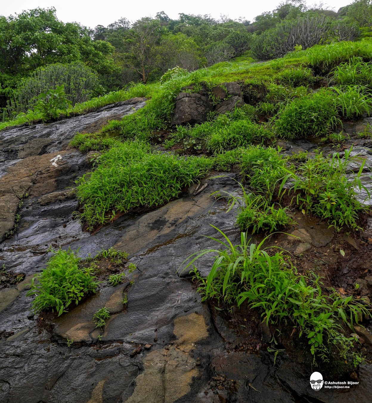
As I climbed higher, the short grassy path gave way to a path through thick vegetation and forest. Thankfully it was not raining - I had forgotten to bring the waterproof case for my camera. So I was praying for a dry day today.

The monsoon is a special time in the Sahyadris for the flora and fauna. There are different species of multi-colored fresh water crabs one can see. This article (ref) describes some of the species with some beautiful photographs - though this crab with a sad looking expression did not look like any of those covered in the article.

I soon reached the top of the first hill from where I had to follow the ridge to the taller hill at the other end where the fort was located.

Nature has a way to create dynamic art everywhere. This tree trunk sculpture may have taken years to create but keeps changing every day!

After about an hour's easy climb, I could see the ramparts of the fort up at the top of the hill. It was a short, slightly steep stretch to reach it.

As I turned around the rampart and climbed to the top of the hill, I entered a grassy plateau with a gentle slope leading to a flat peak.

As I walked towards the peak, I was greeted by another crab - this one was darker in color and well camouflaged against the ground. The crab's eyes are on stalks that allow the crab to rotate their eyes in almost any direction and that too, independently from each other.

Due to the independence of the separate stalk eyes, the crab is able to use one eye to analyze the object's form, while simultaneously using the other eye to inquire about it's color and polarization features (ref)
I got this super view once I got to the top of the hill. There were two tanks brimming with water overlooking the valley below. The arrangement of the tanks is so clever, that overflow from the tank at the top passes through another small pit where the mud and silt settles before passing into the larger tank below.

I found the holes in the rocks around the tank that are used to insert poles that support a roof over the tank so as to prevent evaporation (ref: Asst. Prof. Kurush Dalal)
Taking advantage of the merciful lack of rain, I played around with my camera. I placed it on a rock at one end of the tank and took this photograph on timer. Pity you cannot see my thoughtful look :)

The main attraction of the fort is this large water harvesting tank that collects water and is held together with a retaining wall built on the far side. The level of water is low because the retaining wall is now damaged.

The only structure other than water tanks on the fort is a rectangular structure that seems to be the remnants of a living quarters or guard house.

On closer examination, I found that the walls of this structure were made of meticulously cut blocks of stone. However, the structure had disintegrated due to it being overtaken by the vegetation. I wondered... is restoration at the cost of chopping down the trees that have grown into the ruins the right thing to do?

The fort does not have ramparts all around. There are just small sections where retaining walls have been built. I walked around the fort along this narrow pathway to get a glimpse of the surrounding countryside.

Looking eastwards, one can see the small lake near Mamacha Gaon and a little further in the distance, the Surya river running from left (north) to right (south) towards the confluence with the Vaitarna river.

Looking southwards, one can see the highest peak of this sub-range - the peak of Kaldurg Fort and the Devkhop lake in front of it. Tandulwadi fort is hidden behind and not visible.

This satellite picture provides a good reference to the above two views with the three forts along the muontain range, Devkhop lake near Kaldurg and Surya river running on the left towards the confluence that can be seen near Vasare.

I was the first trekker for the day and I saw a group of fellow trekkers climb up and join me. They were a bunch of college friends who came here for a reunion on occasion of one of them returning from Dubai. The plateau to the south from where I entered provided them a nice venue for a reunion!

My hope for a dry day started looking dismal when dark clouds gathered ominously around the fort. With no rain protection for my camera, and no dry place to stay away from the rain, I got concerned.

Sure enough, in a few minutes it started pouring. I dashed to the edge of the large water tank where a tree provided limited shelter.

Luckily the rain stopped after a short while. It left me drenched, but I had shoved the camera deep into my backpack and it was safe. I took the opportunity to examine the breach in the retaining wall of the water tank. It surely looked like it could be fixed. Should be a good project to take up!

There is a small gate of sorts to the east, not too far from the big tank. I noticed the white arrow and guessed that this must be the way down the second route to the east.

It was now time to start climbing down. I had read about a cave called Ganesh Gupha (ref, ref) that is on the east slope of the mountain that I did not want to miss.
A short climb down brought me to this rock face overgrown with moss with water flowing all over it. The arrow brazenly pointed straight down the rock face. Trying to climb down this without any support is not a good idea! Please do not try this on your own!

I did not heed my own warning though, and gingerly went down the rock face, carefully trying to avoid the slippery parts, testing each step for grip before putting my weight on it. Half way down, I looked up and thought it may have been better to climb this way up rather than down.
And moreover, this may be much safer when it is not monsoon. The rock face continued for approximately 400-500 feet - about half way down the mountain.

Finally I reached the end of the rock face. I saw a path going towards the north and followed it to look for the cave.

The cave is quite large - my guess is about 50 feet wide and 30 feet high at the mouth.

In the cave is a depression in which water has collected. Apparently this water lasts through the year (ref). I took a quick wash in the water to refresh myself from the harrowing climb down the rock face.

To get an idea of the size of the cave, this photograph has a group of trekkers who had stayed overnight in the cave. They had setup their kitchen with logs of wood and pots in which they had started cooking their lunch. They invited me to join them, but I was keen to continue my descent and politely declined.

Downwards from the cave, the path is not as steep or difficult. There are arrows that continue to provide direction and I just followed them till I reached the bottom.

I had to cross this stream and then turn left (north) towards Mamacha Gaon resort.

As I came closer to the resort, the forest gave way to paddy fields belonging to the village Gundale.

I saw this teenage boy gracefully throwing something into the field with sweeping strokes. I watched him for a while and then interrupted him to ask what he was doing. He said he was throwing fertilizer in the field. He did not know the composition of the fertilizer... I hoped that it was organic - both for the sake of the rice and for the boy as he was handling the fertilizer with bare hands.

At another field nearby, I met with this couple who was busy transplanting the rice saplings. They paused to chat with me, and inquired where I came from and what I did for a living. I told them I would like to do get out of the city and live in a farm too, but seeing how much hard work there was, I was hesitating. They reassured me that it is not very hard, though it does get hectic in some months of the year.

At some points, the path went through these fences made from sticks and branches carefully woven together to prevent animals from straying but providing humans a way to cross over.

I passed by Mamacha Gaon resort but decided to skip it for now and and drive back later to have lunch there. I had to go all around the mountain via the Boisar road to get back to my starting point. Instead of going around the Viraj factory, I thought of taking a shortcut behind it. But there I was almost stuck in a deep muddy field and the soles of my shoes (old army boots) actually came off!

When I got back to my jeep, I took off my shoes and discarded them at the back of the jeep and drove barefoot to Mamacha Gaon. The receptionist saw this dirty looking old man without shoes asking if they would serve lunch. He retorted sternly that it would cost Rs. 500 for a special buffet lunch and he did not have anything else! I agreed to have the "special lunch" and he insisted that I pay him in advance. So much for appearances!

But the lunch was great! I was famished and managed to tuck in the Malwani chicken curry and rotis with relish!
Satisfied with the weekend adventure, I headed back to Mumbai, thanking myself for not having tried this adventure on bicycle, for I would have had a hard time riding back after the trek!